Rail Trail
Charlotte Rail Trail
The Blue Line Rail Trail is an 11-mile-long pedestrian/bicycle facility that runs parallel to Charlotte's LYNX Blue Line light rail. In some places, the Blue Line Rail Trail is an urban greenway lined with shops, restaurants, outdoor seating, and games. In other places, it transitions to a more modest facility defined by bike lanes and sidewalks. The trail connects to 15 different bicycle routes and multiple major destinations. It has become one of the signature pedestrian and bicycle routes in Charlotte with over 2,000 trail users per day in some locations.
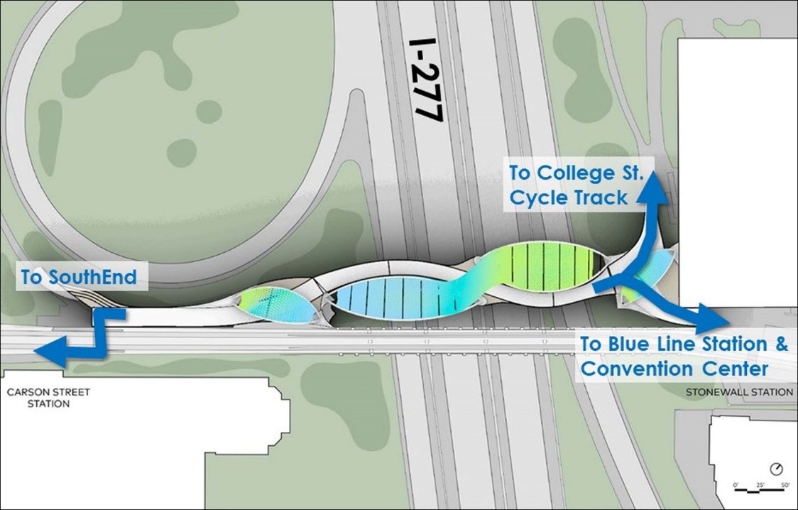
Stretching from the Sugar Creek Station to the Arrowood Station, the 11-mile Rail Trail alignment has only a few key gaps remaining. The City of Charlotte, in partnership with adjacent landowners/developers and other stakeholders, is working to fill those gaps through projects like the Rail Trail bridge over I-277, the Uptown CycleLink, and the Cross Charlotte Trail.
History & Evolution
The original purpose of the Blue Line Rail Trail was simply to provide access from nearby streets to four rapid transit stations. However, since the Blue Line began operating in late 2007, the Rail Trail has been added onto, studied, enhanced, formalized, and transformed. The current Rail Trail goes far beyond the utilitarian path of 2007. It is now an important part of Charlotte's urban fabric.
Thousands of new residents, living in gleaming new apartment buildings and townhomes within a stone's throw of the Rail Trail, use it for jogging, cycling, commuting, dog walking, hanging out, dining, drinking, shopping, and bicycling. For many, the Rail Trail is literally at their front door, since Charlotte's development regulations often require direct connections from adjacent buildings to the trail for both commercial and residential buildings. Charlotte Center City Partners and Historic SouthEnd now play a key role in programming and supporting the Rail Trail in SouthEnd and Uptown. You can check out their Rail Trail website to learn more about the trail and upcoming projects and events.
The Rail Trail is a place where urban design concepts are tried and tested, where lessons are learned and adjustments are made. It's a platform that supports interesting and unusual public spaces and "interventions", where formal regulatory requirements sometimes clash with free-form guerrilla placemaking, spontaneity, and grassroots (and often anonymous) art and sculpture.