Reedy Creek Stream Restoration

Reedy Creek with blooming yellow flowers.

Overview

This innovative project is located within the environmentally significant Reedy Creek Nature Preserve and involved restoration of deeply incised, eroded stream channels. Appropriately sized stable channels were reconnected to their floodplain and existing high-quality streams and wetlands were preserved. The project protected and enhanced 15,000+ feet of headwater streams, restored 26,000+ feet of streams and protected 4+ acres of wetlands. This project created, enhanced and protected forested riparian areas and aquatic habitat.

Project Goals

What is stream restoration? 
Stream restoration repairs a damaged stream to a more natural condition.

How does stream restoration help the environment? 
Eroded or damaged streams are bad for the environment because sediment from the stream banks gets into the water. Water that is cloudy from sediment stresses fish and other aquatic life. The sediment may drop out onto the stream bed, which could cover up aquatic habitats.

If a stream has eroded its bed and is very deep, water may not get out of the channel and onto the stream’s floodplain during big storms. A floodplain is important because it helps to slow down storm water flow. Slow moving water on a floodplain may infiltrate into the ground, or it may puddle up for a while. When water infiltrates into the soil, the soil acts like a filter and removes pollutants. When water puddles up on top of the soil, pollutants can drop out of the water. Either way, an active floodplain helps remove pollutants and makes the water quality better.

Project Goals

1. Stabilize eroding stream banks

2. Restore the floodplain along the streams to their natural function

3. Return the stream path to a more natural pattern

4. Improve habitat

5. Enhance water quality

6. Reduce pollution in Reedy Creek and its tributaries

Project Map

The project area was roughly bounded by Plaza Road Extension to the south and south-east, Rocky River Road to the north, and Hood Road to the east. There were approximately 25,000 linear feet of stream running through both private and public property in and around the project area.

Reedy Creek Stream Restoration Project Map

Project Timeline

Reedy Creek Stream Restoration Project Before and After.

Survey Phase (2014) 
During the survey phase, the streams were studied to learn about habitat and to measure erosion. Surveyors completed land surveys and scientists studied the streams. 

Outreach Phase (2014) 
During the outreach phase, the project team met with the public and stakeholders to introduce the project and answer questions. This phase continued throughout the project.

Design Phase (2014) 
During the design phase, construction drawings for the project were developed. This involved designing the changes to the stream, laying out easements, and picking out plants. The design phase of this project continued through 2016.

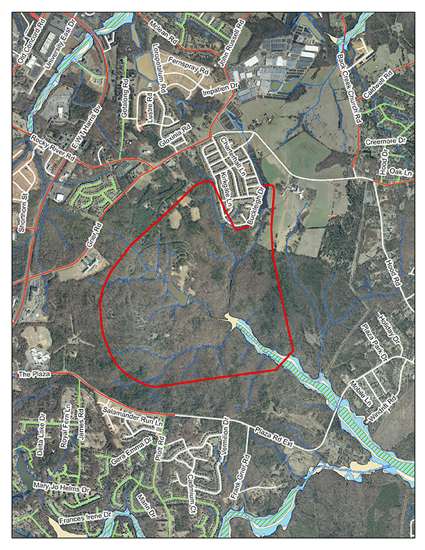
Property Easement/Acquisition (2015) 
The project team worked with Mecklenburg County Parks & Recreation and landowners to put land around the streams in conservation easements to protect the streams. Temporary construction easements were acquired to gain access to the streams. The conservation easement acquisition phase of the project continued through 2016.

Permitting Phase (2015) 
During the permitting phase, the required permits were obtained from federal, state, and local government. 

Construction Phase (2017 to 2019) 

Monitoring (2019 to February 2024) 
The completed project was monitored for five years after construction. During this time, scientists monitored vegetation and surface water quality.